
In the darkness, I entered Nevada, and everything suddenly became bright. 152149 miles.
Half hour later, I parked at a parking structure at the largest hotel in the world -- MGM Grand Hotel & Casino in Las Vegas, NV. Sat down at a blackjack table.
Up $60, down $30, back up again $11. Kept a $1 coin as a souvenir and cashed the rest. End result = + $10.00.
Just after dawn, I left the casino. Saw the beautiful sunrise behind the mountains, but the temperature was also already WAY UP THERE!
I arrived at the town of Mesquite and decided to take a short nap again in front of the same Burger King where I had eaten my trip's first meal. I parked in front of the restaurant and reclined the car seat, but could not go to sleep. I was very tired, but the temperature was just too unbearable!
I went inside the air-conditioned "Virgin River Casino" and sat down at another blackjack table. Won again. $63 minus $1 souvenir coin. Total winnings so far = $72 in three hours of playing.
I had earned enough money for the next two nights' motel stays, so I left the casino and went to the Burger King again for breakfast. Paid a buck for breakfast, then went back to the car. This was at 8:00 AM.
I was sweating.
Went back to the air-conditioned casino. Sat at the same blackjack table as before. The other players at the table were the same as before, but the dealer was different. Got more money ($47).
I had won a total of $119 today (plus $2 in souvenir coins). Again, I was carrying a lot of cash in my wallet -- something I did not like.
I left Mesquite at 10:35 AM [Pacific Time]. Less than one minute later, I entered Arizona:
11:35 AM [Mountain Time] Entered Arizona; 152272 miles. Extremely hot.
12:10 PM Entered Utah; 152302 miles. The drinks I had bought in the Ralphs store back home were ice-cold when I had bought them. Now, the cans themselves were hot! The drinks were undrinkable.
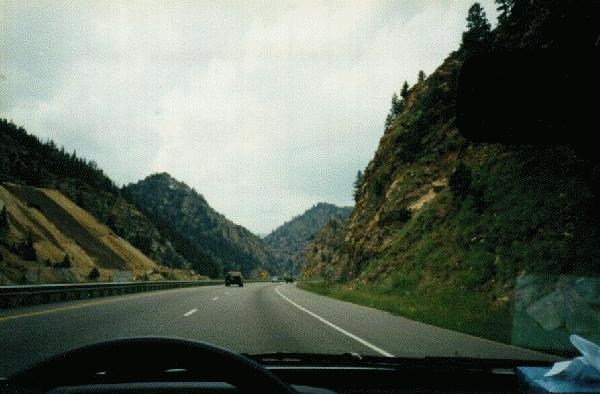
2:20 PM Start of I-70 Eastbound; End of I-70 Westbound. 152429 miles.
2:50 PM The heat was too much, and I had to find an air conditioned place quickly. I knew of one nearby -- the same motel in the town of Richfield where I had slept on my last night before coming back home just a few days ago. I exited the freeway and checked in at Romanico Inn. Immediately after checking in and before going to my room, I drove to a Pizza Hut nearby for my lunch. The Pizza Hut was air conditioned, and so was my room. Went to sleep.
License Plates:
| G RYDE | NV | Nissan Maxima |
| GO4ZPIN | CA | BMW |
| -$11 | Cash | Won in blackjack -- MGM Grand Casino | Las Vegas, NV |
| $1 | Cash | Souvenir $1 coin from MGM Grand Casino | Las Vegas, NV |
| -$63 | Cash | Won in blackjack -- Virgin River Casino | Mesquite, NV |
| $1 | Cash | Souvenir $1 coin from Virgin River Casino | Mesquite, NV |
| -$47 | Cash | Won in blackjack -- Virgin River Casino | Mesquite, NV |
| $10 | CB | Gas -- Chevron | Saint George, UT |
| $4 | Cash | Lunch -- Pizza Hut | Richfield, UT |
12:43 PM Passed the town of Salina, UT -- "ATTENTION!!! WE ARE NOT KIDDING! THERE ARE NO SERVICES FOR THE NEXT 108 MILES!!! THERE IS JUST THE SUN, THE UTAH DESERT AND YOU!!!"
Passed the point of no return.
The desert, I could deal with.
The sun, I could deal with.
Me? I'm not too sure about that! I started doing weird stuff again. Driving with no hands, driving with no feet, driving with no hands and no feet, etc...
1:59 PM Started driving in two lanes at the same time; 152559 miles.
2:03 PM Saw a cop. Went into the right lane. 152563 miles. Passed the cop. Drove some distance in the right lane only. Then started driving in both lanes again.
The Utah desert is very beautiful. The sun is very beautiful. What the sun produces is not so nice.
It was a long, hot drive through "the middle of nowhere".
2:24 PM Passed Exit #158 for Green River, UT. 152586 miles.
I had won the battle against the desert, but lost the war against the sun.
Some time later, I stopped in the shade under an overpass to cool the car engine and myself. Drank a Slice.
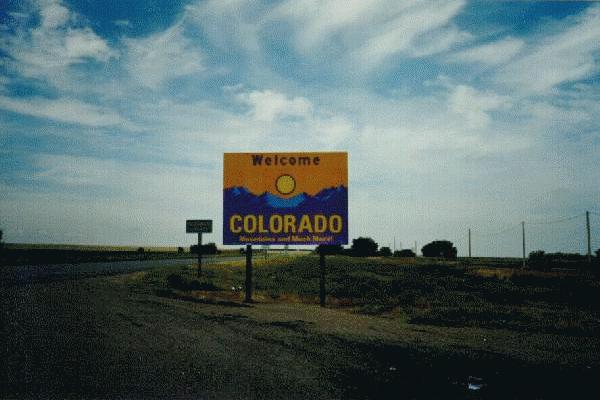 3:45 PM The sun was still shining bright, and it was still very hot. Entered Colorado; 152655 miles.
I came to Grand Junction and checked in at the same motel as on "Part 1" of this trip. The room had air conditioning.
License Plates:
| PLCS2GO | UT | Ford Taurus -- "Places To Go??? Where? How? Can I come?" |
| $34.96 | Chase | Romanico Inn -- Paid in advance last night upon check-in | Richfield, UT |
| $3 | Cash | Crackers-n-stuff at K-Mart | Richfield, UT |
| $3 | Cash | Miserable lunch -- McDonalds | Richfield, UT |
| $7 | CB | Gas -- 66 | Richfield, UT |
| $4 | Cash | Dinner -- Wendys | Grand Junction, CO |
Go to start of this date
Go to start of this section
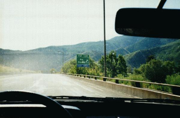
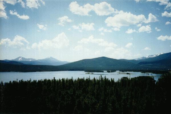
I started driving towards some of the tallest mountains in the country.
I had been here twice so far. The first time, I was just trying my best to survive in a heavy snowfall. The second time was in the summer -- just a few days ago, and I had kept very good records of the miles and elevations before and after each climb. This third time, all I had to do was turn back the pages and refer to my own notes to prepare myself psychologically for what I knew would be tough road ahead. I knew it would be tough on the car as well, since it was getting old.
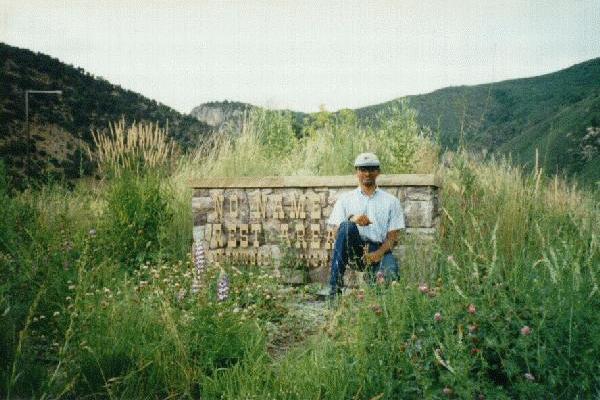
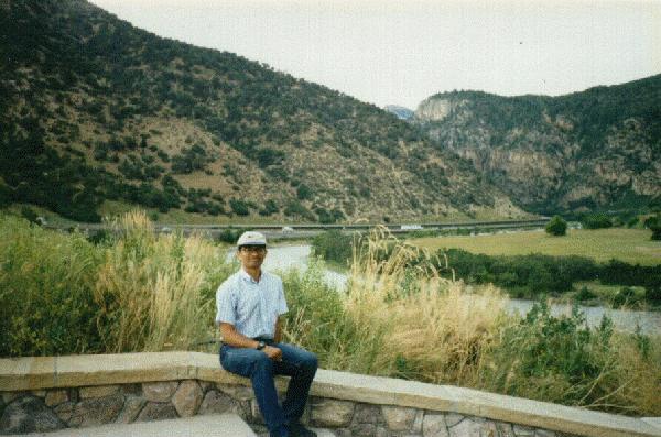
I passed the "No Name" rest area, and soon passed the town of Avon, CO (elevation 7430 feet). One more time, here is a direct copy of my notes written either while driving or on any of the rest stops:
10:35 AM Passed Avon, EL. 7430 ft. 152835 miles. Feeling lightheaded already. 4500 feet to climb from here to Loveland Pass!
10:42 AM Vail, el. 8150 ft. 152844 miles. Gentle but steadily increasing climb.
 10:55 AM STILL climbing... (much more difficult now.)
 10:59 AM Stopped on shoulder after Mile #187 on freeway => VERY STEEP climb -- difficult to stay @ 30 MPH. 152858.
11:09 AM Back on FWY again; "only" 3 more miles to climb according to my
"calculations"![56]
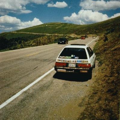
11:12 AM [written in big, bold, red letters:] THE FIRST CLIMB IS COMPLETED!!! Arrived at Vail Pass. El. 10603 feet (mile marker ~189); 152860 miles. Stopped, took picture of "Vail Pass" sign and the triumphant car!!![57]
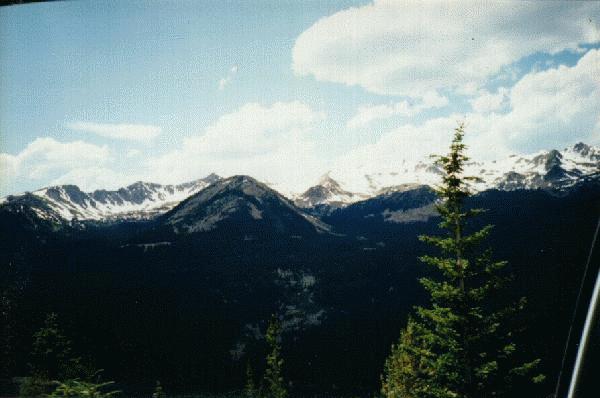
Although the car was having a lot of difficulty climbing, the views of the snow-topped mountains were magnificient!
11:16 AM Back on FWY
11:18 AM Rest area
11:25 AM Left R.A. and continued going down.
Keepin' it in Neutral for the gentle downward slope; occasional gentle climbs controlling the speed!
11:30 AM Back in gear![58]
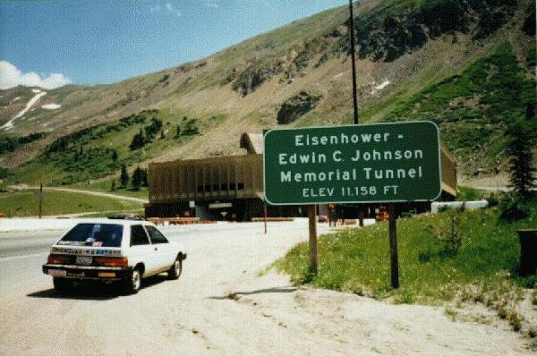 11:55 AM Stopped just before entering Eisenhower Tunnel [2nd climb completed]; 152884; el. 11,158. Took picture of victorious car.
12:00 PM Entered Tunnel.
12:02 PM Out; Loveland Pass; 152886; 11,992 feet[59].
DOWN, DOWN, DOWN!
12:17 PM Took the exit for the road to Rocky Mountain National Park -- Exit #232; 152901 miles; ~8500 ft. The town of Empire, CO nearby is at an elevation of 8601 feet. Immediately after passing the town, there was another steep 15-mile climb on a "Multiple-S-turns" kind of a road that offered spectacular mountain scenery, then came back down again.
Maaah-ve-lus scenery!
Down3
12:52 PM Passing thru Winter Park (el. 9110);152924.
Down2
1:00 PM Passing threw At Frasier (el. 8550); 152930.
I was getting very hungry, and wanted to pick up my lunch to-go at a fast food place, so I could spend the most amount of time at Rocky Mountain National Park. Unfortunately, I did not find any fast food restaurant until I arrived in Frasier. Immediately after entering the town, I wrote in my notebook "Passing threw Frasier" (spelling mistake intentional). I saw a Taco Bell next to the road, and thought I should pick up my lunch here, while I have the chance. After parking at the restaurant, I crossed out "Passing threw" and wrote "At". There was no drive-thru window, so I had to go inside. The line inside was extremely long, and it took almost a half hour for me to get my food. This is not my idea of a "fast food restaurant". I ate the food while driving.
1:25 PM Left Frasier.
Down3
1:40 PM Passing threw Granby; 152946; el. 7935.
1:42 PM Entered Hwy 34 -- this road goes through Rocky Mountain National Park, and I finally realized that my wait of more than one hundred days would be over today. It was a beautiful, sunny day -- finally! 152947.
More or less level road (more more than less[60])
1:58 PM My arrival @ the town of Grand Lake; el. 8369. 152960. Grand Lake, CO is the last town East of Rocky Mountain National Park. I couldn't wait for what lay ahead... I was very, VERY close, and just that thought (the anticipation) was enough to get me excited. I was finally here!!!
152961 miles.
[22,511 miles after leaving home the first time,
And now, back to the "normal" format:
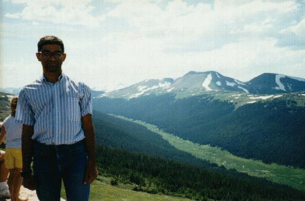
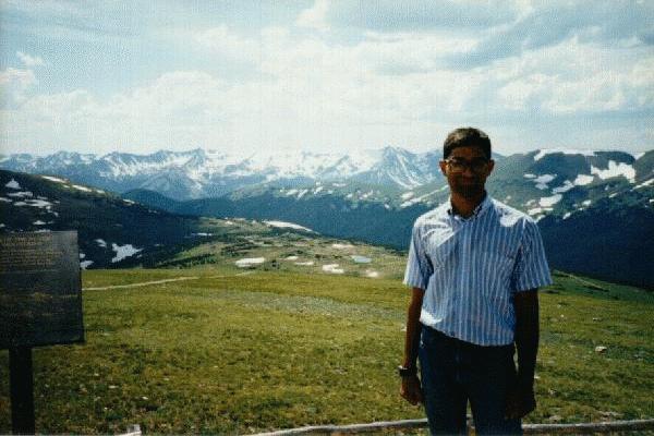
I was wearing a blue jeans and a short-sleeve blue shirt with white stripes when I entered Rocky Mountain National Park. I took a picture of the car with the "Rocky Mountain National Park" sign, then someone else took my picture with the sign. These people also offered to include the car and its bumper stickers in the same photograph, and again, I told them that the car deserves to be in its own picture, without me. I had already taken a picture of the car (before it even occurred to me to take my own picture), so I saw no reason to include the car in this second shot. Instead the people who took my picture with the National Park sign took my photo with my car using their own camera.
I did.
Rating for Rocky Mountain National Park =
4:51 PM Left park. 153003 miles.
The next attraction was Mount Rushmore, which, technically, is a day's drive from Rocky Mountain National Park. I was not feeling tired, so I decided to drive up there tonight! I had done something like this before, and I knew what I was getting myself into. I also knew the landscape ahead -- a flat, straight, level road through absolutely no kind of landscape whatsoever. I would rather drive through that kind of nothingness in the night-time rather than in the daytime. I started driving northwards toward Mount Rushmore.
In Cheyenne, I bought, wrote, stamped, and mailed PC2PG.
I picked up dinner to-go at a drive-thru Burger King in the town of Wheatland, then continued driving.
8:48 PM The flat, dull landscape was wearing me out, and I started to do interesting things again...
The car was moving at 70 Miles Per Hour. I took my right foot off the accelerator, lifted it up, and put it horizontally across and rested it on top of the icebox, which was in front of the passenger-side seat. At the same time, I stepped on the accelerator with my left foot. For the next eight miles, the road was level and I was driving with my left foot only. Then, surprisingly, the road started to climb a little. This was really unexpected, and I considered moving my right leg back in its appropriate position again. Then I thought "that's no fun!" With my left hand on the steering wheel, my right hand holding on to a coke can, my right leg on top of the icebox in front of the passenger seat, and my left leg operating the accelerator and clutch, I downshifted into third gear and accelerated again. When the car had picked up enough speed, I shifted back into fourth gear. My right leg was still resting on top of the icebox!
I had never done anything like this before, and enjoyed doing something this much out of the ordinary! I was driving with my left foot only for twenty-two total minutes, until I had to exit from the freeway. If I did not have to exit, I probably would have continued driving with my left foot. Unfortunately, exiting involved stopping, and that meant I had to use both legs again!
9:10 PM Took Exit #126 off I-25 for the town of Lusk, WY. Driving with both legs again. My right leg had been on top of the ice box for the last 34 miles.
After exiting, I was on U.S. Highways 18 and 20 (common road). A railroad track goes along the road for almost the entire length of the road until Lusk. There was a train going in the same direction as us[61]. Since I had nothing else to do and did not feel like driving with one foot again, I went faster and faster until I had caught up with the train's engine. After my car and the train's engine were going almost side-by side, I slowed down to the same speed as the train. It was a game. "Can I do `formation driving' with a train?" After a while, I think the train's engineer realized what I was doing, and decided to play along. He suddenly accelerated, and blew the horn as a signal for me to "catch up". I accelerated too, caught up to the engine, then slowed down again to the same speed as the train. After a while, it was my turn to go faster. After I was a few hundred feet in front of the engine, I flashed the car's high-beams on and off. This was my signal. Soon, the train accelerated. Immediately after catching up to me, the train slowed down, and we riding together again. This going back-and-forth went on for the next half hour. Here was a fellow traveler and a driver, who knew exactly what I was going through by driving through this region, and understood that I also knew what he was going through. Although neither one of us saw each other on that dark night, this "game" was a good diversion from the flatness of the landscape.
Just before the town of Lusk, the railroad track branches off away from the road. As the train went its way, the engineer blew the horn again as a "Good-bye". So did I, although my reason was "Thank You".
Soon after the parting of the ways, I checked in at a Best Western in the town of Lusk, WY. After checking in, I had to drive to the parking space in front of my room. When I parked in front of my room, I turned off the engine just a fraction of a second before coming to a full stop. When I turned the engine off, I heard a "TIK TIK" in the engine. That was not a good sound. Still, I did not think too much about it then.
Miscellaneous: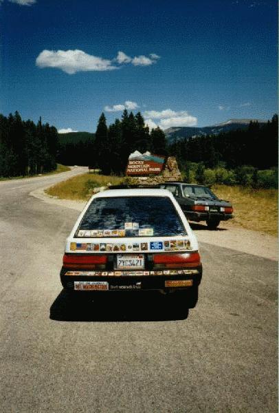 2:00:00 PM After 108 days of waiting, FINALLY entered:
"THE" PARK.
Had my picture taken in front of sign!!!
1,043 miles after leaving home the second time!!!]
 I stopped at the visitor center, but left almost immediately -- I couldn't wait to see this place!
 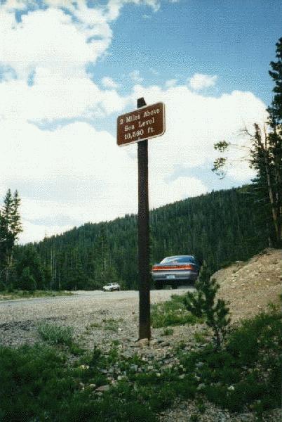 Took a photo of a sign that says "2 Miles Above Sea Level -- 10,560 ft.". Crossed the "Continental Divide" -- again.
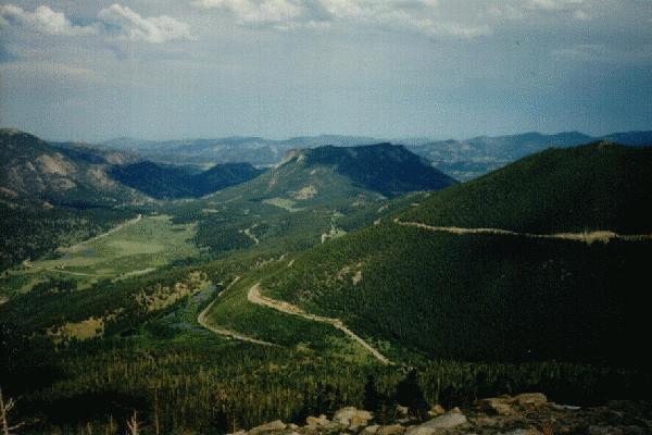
 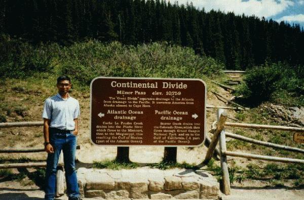 Took another picture. But the scenery was not all I had hoped it would be. So far, all I was seeing was "rolling", round-top hills without any snow on them. I was a little disappointed -- at first. As I continued driving, the road suddenly climbed almost two thousand feet. It was then that I saw what I had been waiting to see for so long.
3:37 PM At Highest Point on Trail Ridge Road = 12,183 feet. This was also the highest point on this entire trip. From there, I could see layers upon layers of mountain ranges stretching off far into the horizon. Everywhere I looked, I saw only white. There were green shrubs and bushes and brown rock below, but my eyes were looking at the white, jagged peaks. One particular range is called "Never Summer Range", which is an appropriate name, no matter how unusual or funny. The peaks I saw from this point were no longer the "rolling" kind. These were jagged mountains with sharp curves, sudden inclines and ^-shaped tops. Seeing that made up my mind about giving this park a 5- rating. Now if I could only see something even better.....
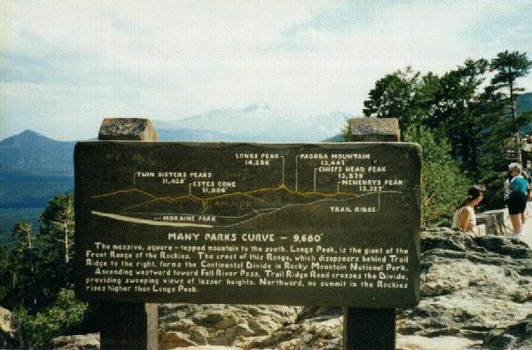
After driving a few more miles, I came to the section of the road called "MANY PARKS CURVE" -- elevation 9680 feet. From here, I had a combined view of opposite extremes in landscapes. On one side, I could see the Great Plains stretching out as far as I could see -- this was a flat, level terrain. On the other side of the road are mountains -- some of them the tallest ones in the country, and all of them more than 11,000 feet tall. One of these mountains has a square-shaped top and rises high above all other mountains around it. This one is called "Longs Peak". It is 14,256 feet tall, and no summit in the Rockies to the North of Longs Peak rises higher. Looking at one of the tallest mountains in the country and the flattest landscape in the country at the same time was "the unexpected something" that made me decide on this park's rating.
.
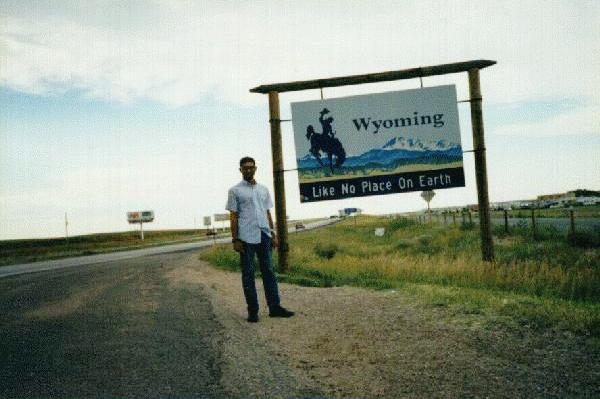 6:45 PM - 6:55 PM At Wyoming state line. After taking a "self-portrait", I stuck the Wyoming and North Dakota stickers on the car. I had not been to North Dakota yet, but since I would be there shortly, I put that sticker on as well. 153077 miles.
Town:
Chugwater, WY
License Plates:
SKRYPEK
IL
Ford van
MAZFICA
CO
Isuzu
2 LOVE
CO
Volvo
DAYOFF
CO
Truck
BAMPAW
CO
Plymouth Voyager
NOGOMR
CO
Twin Cam
Expenses:
$48.24
Chase
Clifton Inn -- paid July 28 upon check-in
Grand Junction, CO
$12.86
CB
Gas over-fill-up -- CONOCO
Glenwood Springs, CO
$3
Cash
Lunch -- Taco Bell
Frasier, CO
$9
CB
Gas -- Flying J travel plaza
Cheyenne, WY
$3
Cash
Dinner -- Burger King
Wheatland, WY
Nine minutes after Eleven O'clock, the road actually turned!!!
11:13 AM AGAIN! WOW!
Then, I saw TWO trees!!!
 A little while later, I entered South Dakota -- again. 153294 miles.
Soon after, I entered Black Hills National Forest, where I saw several more trees.
As I was nearing the Mount Rushmore region, a police car started following me. I slowed down to a few miles under the speed limit, and kept driving, waiting for the police car to either pass me or turn off the road. When the police stayed behind me, I started to get a little nervous.
Soon, the lights on top started to flash. I pulled over on the side of the road. The police officer got out, came to my car, signaled to me to roll my window down, did not ask me for my driver's license, and told me to "GET OUT OF THE CAR!". I told him I would get out immediately after putting on my shoes, and he waited while I took my time to put on my shoes. I did everything slowly. After getting out of the car, he asked me for my driver's license. I told him my wallet was in the glove compartment, so I would have to get back inside to get the wallet out! He was getting quite frustrated at all this, but I didn't care. He did not exactly have a "friendly" attitude. I took my own time to walk (slowly) to the passenger side of the car, unlock the door (after pretending to look for the right key), open the door, lean inside, open the glove compartment, take out the wallet, close the glove compartment, lock the passenger door, close the door, then walk (slowly again) to the driver's side, where the police officer was standing. Once I got there, I took out my driver's license and gave it to him. He snatched it from my hand, then told me to walk with him to his car and get in the front passenger seat of the police car. He still had not told me why he stopped me.
Once we were both inside the police car, he called his operator for a check-up on my license number. Then, he asked me if I was "intoxicated". I knew this trick -- I had seen it in a movie. A person who is intoxicated will not be able to say the word "intoxicated". I told the officer, and I quote, "No, sir. I am not intoxicated." I did not stutter on the word "intoxicated", and he knew then I was sober. He finally told me why he had stopped me --
| Police Officer: | "The reason why I stopped you was because you were driving on the right half of your lane and not in the center of the lane." |
| Me: | "Is that against the law?" [I asked that without thinking. His reason sounded so absurd that I just blurted this question out. When I asked him that, he got even more upset...] |
| Police Officer: | "YES, IT IS AGAINST THE LAW!!! YOU ARE SUPPOSED TO DRIVE IN THE MIDDLE OF THE LANE!!! THE WAY YOU WERE DRIVING, IT LOOKED LIKE YOU WERE GOING TO GO OFF THE ROAD!!!" |
| Me: | "All right. I'm sorry." |
| Police Officer: | "So are you here on vacation?" |
| Me: | "Yes." |
| Police Officer: | "What are all those stickers on the back of your car?"' |
| Me: | "All the states I have been to on this trip." |
| Police Officer: | "THAT MANY?" |
| Me: | "Yes." |
| Police Officer: | "Look, I'm going to let you go with a warning. Just drive in the center of the lane, O.K.?" |
| Me: | "All right. Thanks." |
He wrote a "warning" form, gave me a copy, and let me go.
The first sightseeing attraction I saw in the Black Hills region was "Crazy Horse Memorial". The admission to the parking lot/viewing area was $6.00. The Crazy Horse Memorial is a memorial to the Indian Chief Crazy Horse, and is in progress of being sculpted out of a mountain. The part that was finished was very clearly visible from the road, and I saw no point in giving $6.00 to see the same mountain from a parking lot not far from the road. I stopped next to the road, glanced at the mountain, then continued driving. .
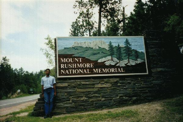 1:35 PM Entered Mount Rushmore National Memorial. Started driving towards the famous mountain, keeping my eye out for the famous faces.
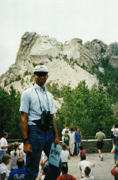
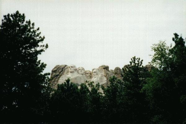
Six minutes later, I saw the faces, then parked at a nearby parking lot (free). Walked to the mountain, saw it, walked back to the car. The mountain was impressive, considering the sizes of each face. With my binoculars, I could see eyeglasses on Teddy Roosevelt's face. I knew Teddy Roosevelt wore eyeglasses, but I had never noticed them on photographs of Mount Rushmore! With the binoculars, I could also see several details in each face, and I was very impressed with what I saw -- each strand of hair, each wrinkle in the faces, ... EVERYTHING... is sculpted out of the rock. . One of the Mount Rushmore postcards I sent to Perry had a side-view of Abraham Lincoln, showing some repairwork being done on his very prominent nose. As an inside "family joke", I wrote on the back of the card:
perry,
...and I thought OUR noses were big!!!
That was all I wrote on that card. That joke was the sole purpose of buying that particular card.
After mailing the card from the visitor center, I came back out to see the sizes of each person's nose compared to the faces. I noticed all four noses are relatively large for the faces!
I left Mount Rushmore and drove North to Rapid City. Went to a mall and got my photos developed at a Ritz Camera store. Then came back to the Black Hills region and checked in at a motel in the town of Custer, SD.
Mount Rushmore is also illuminated by floodlights at night, and I seriously considered going there again that night. Did not go (I had convinced myself that nothing could compare to the lighting of Niagara Falls or the monuments in Washington DC). Stayed in motel and watched T.V.
Expenses:
| $41.04 | Chase | Best Western Inn | Lusk, WY |
| $8.98 | CB | Coke-n-stuff, but no gasoline -- EXXON gas station | Custer, SD |
| $21.88 | CB | Film Developing -- RITZ 1-Hour Camera -- Rushmore Mall | Rapid City, SD |
| $6.35 | CB | Snacks-n-stuff -- Rushmore Mall | Rapid City, SD |
| $4 | Cash | "Meal of the Day" -- McDonalds | Rapid City, SD |
| $11 | CB | Gasoline | Sinclair, SD |
Go to start of this date
Go to start of this section
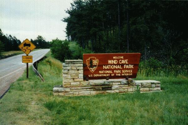 I drove to Wind Cave National Park, which is just a few miles south of the town of Custer, SD. I did not go inside the caves, so the rating is meaningless: .
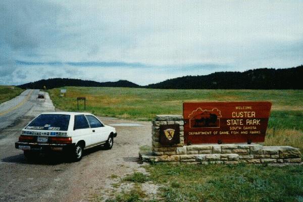 After driving through Wind Cave National Park, I went to Custer State Park, which is also nearby. This one had a "Wildlife Loop Road". The only wildlife (besides myself) that I saw was a few herds of bison.
  . After that, I started driving North towards the state of North Dakota. The road was scenic at first, passing by some low hills.
I ate a (free) lunch[62] at a Burger King in Spearfish, stopped at a nearby Wallmart for chips-n-stuff, then continued driving Northward. I mentally prepared myself for a non-scenic, dull road all the way to North Dakota. I started thinking about what my next "driving style" would be.
Half hour after leaving Spearfish, I was in the town of Belle Fourche, SD. This was like any other town, and I did not think too much about its significance as I was passing through it. Near the business district of this town was a building. In front of the building, there was a sign that said,
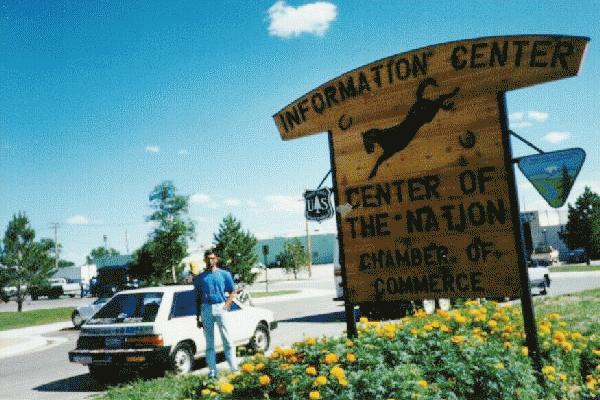 INFORMATION CENTER
CENTER OF THE NATION
CHAMBER OF COMMERCE
The words "Center of the Nation" caught my eye. I did not know that this place was the center of the nation. I stopped there and went inside for more information. I found out that the exact geographical center of the nation is just a few miles North of the town of Belle Fourche. They gave me a free postcard in exchange for a donation of $1, and I wrote and mailed it immediately. Then I took an (automatic timer) photograph of the "Center of the Nation" sign together with both me and my car (with all the state-stickers). This "attraction" was an unexpected, yet inevitable, part of a very long journey.
I had been told at the information center that the ACTUAL center of the nation is a few miles up the road, and that there is a plaque at the exact center. The person who told me this also told me NOT TO stop there. Recently, a group of rattlesnakes had made the center of the nation their home, and a few imposing tourists were unfortunate enough to find this out for themselves. I told her I would not stop there, but I had every intention to stop! How could I take a trip like this and not stop at the center of the country?!?
As I continued driving North, I started to look for signs for the center of the nation. When I did not see any signs, I started to look for rattlesnakes! I did not find any rattlers either! How unfortunate!
I continued driving towards North Dakota.
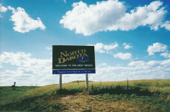 5:30 PM Entered State #44 on this trip, #46 overall. Bin two oll stayts xept Alaska, Hawaii, Washington, Montana. 153672 Miles.
A couple of hours later, I checked in at a Super 8 motel in the town of Dickinson, ND -- this was the only real "town" that I went to in this state.
Miscellaneous:
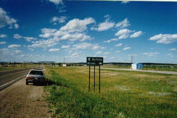
| Town: | Buffalo, SD -- See below |
| Town: | Bison, SD -- both Buffalo and Bison are within an hour's drive from each other. I went through Buffalo, SD; Bison was a little out of my way. |
| SUZ BUS | WI | Chevrolet Astro Minivan |
| SUPER Q | KS | Cadillac |
| OHMOM X 4 | IL | Ford |
| I AGREE | WI | Corvette -- must belong to a politician! |
| RACY | ND | Dodge Daytona |
| LO N SLO | ND | (Toyota?) truck |
| $51.84 | Chase | Rocket Motel -- paid upon check-in | Custer, SD |
| $3 | Cash | Admission -- Custer State Park | South Dakota |
| $6 | Cash | Chips-n-snacks-n-stuff -- Wallmart | Spearfish, SD |
| $1 | Cash | Postcard -- Center of the Nation Chamber of Commerce/Information Center | Belle Fourche, SD |
| $10.70 | CB | Gas -- CONOCO | Bowman, ND |
| $4 | Cash | Dinner -- Burger King | Dickinson, ND |
Go to start of this date
Go to start of this section
Continue on to August 1
[55]In the past, whenever I had slept in a rest area, I had trouble falling asleep because it was too cold outside. This time, I had trouble falling asleep because it was too hot outside!
[56]All through the drive, I kept looking at my notes and counting the number of miles remaining to the top of the mountain... The car was at its breaking point, yet slowly but steadily kept climbing higher and higher...
[57]The first climb going west-bound is the most difficult climb of them all, and the car had made it to the top! I was overjoyed, yet worried at the same time -- I could feel the strain on the engine as it pulled the car up.
[58]"Oh great! Here we go back up again!!!"
[59]Although that is what I wrote in my notebook, the elevation is wrong. Eisenhower Tunnel is a level road, and therefore the elevations at the start and end of the tunnel are the same! Loveland Pass is actually a few miles South of this point. On the AAA Colorado map, the words "Loveland Pass" take up so much room that I thought the freeway goes through the pass. Not true.
[60]Meaning the road was going up more than it was going down!
[61]The car and I.
[62]Paid for using left-over change.